Tweet This! :)

Friday, February 28, 2025

Driving innovation: ‘Think different’

@Mark Ollig


The January 1975 front cover of Popular Electronics featured a photograph of the build-it-yourself Altair 8800, which was called “World’s First Minicomputer Kit to Rival Commercial Models.”

The Altair 8800 kit, which included the components, cost $397 ($2,346 today), while a fully assembled Altair 8800 computer sold for $498 ($2,921 today).

“If you can handle a soldering iron and follow simple instructions, you can build a computer,” read the Altair 8800 advertisement.

Yes, I could handle a soldering iron very well back then.

The Altair 8800 had a brushed metal front panel with two rows of toggle switches and red LED lights.

The top row featured 16 switches for entering memory addresses, while the bottom row controlled functions like “run” and “stop.”

Each switch represented a binary digit in a 16-bit address, allowing users to set the desired memory location. LED lights displayed data values and system status.

Programming the Altair 8800 required knowledge of binary code. Users would input the binary code using the switches on the front panel and then view the output via the LED lights.

During the 1970s, electronic hobbyists became proficient at assembling various microcomputer kits, often referred to as “hobby machines” or “homebrew computers.”

The sense of community and knowledge sharing among these hobbyists led to the formation of many computer clubs across the country.

In 1975, Steve Wozniak, along with his friend Steve Jobs, joined the Homebrew Computer Club, an organization of computing hobbyists located in today’s Silicon Valley, CA.

Its first meeting was hosted March 5, 1975, in Gordon French’s garage in Menlo Park, CA. Some 32 attendees shared questions, comments, and experiences, and exchanged information on the technologies used to build computers.

The meeting involved a mix of hardware experts and software programmers, with six members already operating homebrew systems and others building computers with Altair 8800 kits and the 8008 microprocessor released in 1972.

It was reportedly a spontaneous, collaborative atmosphere that fostered dynamic idea exchange, and the club would meet every two weeks.

At one Homebrew Club meeting, Wozniak, who was designing calculators at Hewlett/Packard in Cupertino, CA, presented a working computer he had designed and built.

The computer included several features not commonly found on other hobbyist computers, such as a keyboard, which allowed a user to type programming code instead of toggling switches to input information.

With Wozniak’s computer, both the code input and the computer’s output were displayed on a television screen, which was the portable Sears color television he had brought from his home.

He had wired the television to the computer’s circuitry board and then made the wiring connections to the keyboard.

Wozniak had no plans to sell his computer. Instead, he wanted to share it with fellow hobbyists at the Homebrew Computer Club, gathering feedback and refining his design – until Jobs saw its potential as a product and suggested, “You know, people are interested; why don’t we start a company?”

The computer he demonstrated at the Homebrew Computer Club would become the first Apple computer, the Apple I, built by Steve “Woz” Wozniak.

Wozniak, Jobs, and Ronald Wayne co-founded Apple Computer Company April 1, 1976.

Ronald Wayne was the lesser-known third co-founder of Apple Computer, although he was noted for designing the company’s first logo.

Twelve days after Apple was founded, Wayne sold his 10% stake back to Jobs and Wozniak for $800, as he was concerned about the financial risk.

In 1977, he received an additional $1,500 to waive any future claims against Apple, which today has a market value of $3.3T (trillion) and is expected to reach $4T this year.

“When I built this Apple I… and sort of the first keyboard… [I felt] the first computer should look like a typewriter,” Wozniak said in an interview. “So, it should have a keyboard. And the output device is the TV set.”

“The Apple I and II were designed strictly on a hobby, for-fun basis, not to be a product for a company. They were meant to bring down to the [Homebrew] club and put on the table during the random access period and demonstrate,” Wozniak wrote.

He aimed to improve the technical efficiency of the Apple II computer by incorporating features like color graphics, sound, and expansion slots.

Jobs supported a molded plastic case and a marketing strategy that would appeal to consumers.

In the Dec. 18, 1977, San Francisco Examiner, the Apple II computer with 4K of RAM was priced at $1,298, equivalent to $6,715.59 today; with 16K of RAM, it sold for $1,698 ($8,686 today).

Wednesday, March 5, marks the 50th anniversary of the Homebrew Computer Club’s first meeting.

In 2011, I was very fortunate to have Steve Wozniak personally sign and write a message in his book “iWoz,” which says on the front cover, “How I invented the personal computer, co-founded Apple, and had fun doing it.”

The book was a birthday gift for my son, Mathew, an Apple computer user, who was thrilled to receive the handwritten “Think Different” message from Steve Wozniak, aka “Woz.”

Steve Wozniak’s signature from his book “iWoz.” 
(Photo courtesy Mathew Ollig)


Thursday, February 20, 2025

Birth of the telephone directory

@Mark Ollig


In late 1877, George Willard Coy (1836 to 1915), a Civil War veteran, obtained a telephone franchise from the Bell Telephone Co., established earlier that year.

He opened the District Telephone Company of New Haven, CT, Jan. 28, 1878, the first commercial telephone exchange.

The New Haven District Telephone Co. published the world’s first telephone directory Feb. 21, 1878.

This single-page cardboard directory listed approximately 50 subscriber businesses and residences with telephones – without telephone numbers.

When a caller wanted to reach a specific subscriber, they would signal and provide the subscriber’s name to the telephone switchboard operator, who would then connect the call.

George W. Coy built the telephone switchboard, the first in the US, assembling it himself using materials from a local telegraph company and household “carriage bolts, handles from teapot lids, and bustle wire.”

Early telephones required a single wire for transmission, with an earth-ground used as the return path to complete a talk circuit.

Wet batteries or lead-acid batteries with a nominal voltage of 48VDC powered most of the central office telephone equipment.

Magneto telephones were connected to galvanized iron wires strung between poles and attached to glass or porcelain insulators to prevent electrical shorts and signal loss.

Subscriber telephones, like magneto wall phones, relied on dry batteries, such as zinc-carbon dry cells, with a nominal voltage of about 1.5 volts.

Typically, two or three of these cells were connected in series in a magneto phone to power the transmitter (microphone) and the magneto generator (for ringing).

During the 1930s and 1940s, the Winsted Telephone Company (where I once worked for many years) used a single-folded cardboard directory.

The subscriber would crank the hand generator on their magneto phone, creating an electrical ringing current that traveled to the local switchboard, alerting the operator to an incoming call via a spring-loaded metal drop annunciator.

The annunciator, visible above the line connector jack, would fall open when a subscriber signaled the operator by hand-cranking the magneto on their telephone.

An audible click could be heard from the activating relay of the drop annunciator on the switchboard panel.

Other switchboard models illuminated an associated status lamp above the subscriber’s connector jack.

Early telephones used magneto generators and dry-cell batteries, and later models adopted a ‘common-battery’ system from the local telephone office.

In the 1940s, Winsted Telephone Co. used a common-battery system, which eliminated the need for individual dry cell batteries in each telephone and enabled automatic signaling without a user-generated ringing current.

When the phone’s receiver was removed from the switchhook, it completed a circuit and sent a signal to the switchboard.

My grandmother, father, or someone from Winsted who was employed to work the switchboard would see a lamp light or a metal cover drop over the corresponding subscriber line port, signaling that a call was coming in.

The switchboard operator would plug into the line using a patch cord, then connect the call to the requested number using another patch cord and flip a toggle switch to ring the calling party.

In 1947, the US introduced 86 numbering plan areas (area codes) as part of the original North American Numbering Plan Administration (NANPA).

AT&T established NANPA to promote direct-distance dialing and speed up long-distance calling without using an operator.

The same year, Winsted and many other central Minnesota towns were incorporated into the 612 area code.

In 1996, the western segment of the 612 area code, including Winsted, was split off due to escalating demand for phone numbers and reassigned into area code 320.

The 1948 Winsted Telephone Company directory, a double-sided, single-folded cardboard sheet, listed 293 subscriber names with their alphanumeric codes, but it did not include any street addresses.

Back then, a subscriber would lift the telephone receiver off the switchhook and ask the switchboard operator to connect them to the individual or business’s name, or the code from the directory.

Say a subscriber in 1948 wanted to call Glenard Gatz.

Mr. Gatz’s telephone party line code was “10 R 18.” The 10 stood for the line, and the R meant ring, 18, for ring 18.

The calling subscriber would tell the operator, “Connect me to Glenard Gatz,” or “ten, ring 18,” which directed the operator to use Mr. Gatz’s unique ringing pattern on the shared party line to make the connection.

I knew Glen Gatz. He operated the gas station on Second Street, just south of the Winsted Telephone Co., from the building where Al LeDoux previously operated the Phillip’s 66 gas station; I remember Mr. LeDoux, as well.

In the 1940s, Winsted rural telephone lines could serve up to 24 subscribers on a single party line, although eight to 12 subscribers per line was more common.

Those on the party line had to pay attention to the number of rings to figure out who was receiving the call.

I was told many folks on the party line would pick up their receivers to listen in no matter how many rings or to ask if the call was for them.

Brownies Cafe used a private business line, and its number was listed in the directory as “137.”

A subscriber would request either “137” or “Brownies Cafe,” and the switchboard operator would connect their call using a patch cord.

The Coast-To-Coast store’s telephone number was 66.

How many Winsted residents remember Brownies Cafe and the Coast-To-Coast store?

In 1949, Winsted Telephone Company installed a Wilcox Electric electromechanical automatic relay telephone exchange switching system, which allowed Winsted subscribers to use telephones with rotary dials to complete local phone calls without operator assistance.

The 1878 District Telephone Company’s telephone directory can be seen at the University of Connecticut digital archives:https://bit.ly/4hDw1cZ.

Today, most local telephone companies no longer publish printed directories; digital directories are now accessible online or through mobile apps.

Winsted directories from 1948, 1978, 1986, 1987, 1992, 1993, and 1994. 
Photo courtesy Mark Ollig.


Friday, February 14, 2025

YouTube: voice of a generation

@Mark Ollig

YouTube, started by three former PayPal employees, Chad Hurley, Jawed Karim, and Steve Chen, officially began Feb. 15, 2005, at 5:13 a.m. UTC (Coordinated Universal Time).

In San Mateo, CA, where YouTube was founded, this time difference translates to 9:13 p.m. PST (Pacific Standard Time) Feb. 14, 2005.

UTC is the global time standard unaffected by seasonal changes or time zones. PST, used in California, is UTC minus eight hours.

I obtained domain registration details for YouTube.com using the Internet Corporation for Assigned Names and Numbers (ICANN) registration data lookup tool.

This tool now primarily uses the RDAP (Registration Data Access Protocol) database, which has replaced the older WHOIS protocol as of Jan. 28, 2025.

ICANN manages the global domain name system, which ensures that all internet-connected devices have unique addresses and that users can access websites using human-readable names like google.com, instead of complex numerical addresses.

Domain registration details can be accessed using ICANN’s registration data lookup tool at https://lookup.icann.org/en.

Be aware that some information may be restricted due to privacy regulations.

YouTube began its beta testing phase in May 2005 with a select number of users.

After months of beta testing and fine-tuning the platform, YouTube opened its online doors to the world Dec. 15, 2005.

Jawed Karim posted the first video ever uploaded to YouTube, “Me at the Zoo,” April 23, 2005.

In this 18-second video clip, Karim stands in front of an elephant exhibit at the San Diego Zoo, commenting on the animals, “really, really, really long trunks, and that’s cool.”

This historic YouTube video now has 347 million views, and you can watch it here: bit.ly/3Q0ef7w.

Sequoia Capital (an American venture capital firm) initially invested $3.5 million in YouTube Nov. 7, 2005.

In April 2006, YouTube raised an additional $8 million from Sequoia Capital and Artis Capital Management (an investment firm).

The $11.5 million accelerated YouTube’s growth by improving video features and attracting content creators.

By April 2006, YouTube had 35 million daily views, establishing it as the leading online video platform.

Just a year and a half after Karim’s video upload, YouTube was for sale, attracting interest from major companies, including Yahoo! Inc., Microsoft, and Google.

Google eventually secured YouTube’s acquisition, finalizing the deal Nov. 13, 2006, for $1.65 billion.

The deal reportedly took place at a Denny’s near YouTube’s headquarters, which made me wonder if they all ordered the Grand Slam breakfast.

Google CEO Eric Schmidt called the YouTube acquisition the “next step in the evolution of the internet.”

At the time, Google was operating its public video service, video.google.com, which it eventually phased out in 2011.

In 2024, 82% of businesses were using YouTube for video marketing.

YouTube accounted for 37% of all global mobile internet traffic as of December 2024.

As of January of this year, YouTube has 2.7 billion monthly active users worldwide.

Here is a list of the top ten countries with the most YouTube users:

India: 476 million.
United States: 238 million.
Brazil: 147 million.
Indonesia: 139 million.
Mexico: 84.2 million.
Japan: 79.4 million.
Russia: 78.8 million.
Germany: 65.7 million.
Vietnam: 63 million.
Philippines: 58.1 million.
Although YouTube is not officially blocked in Russia, its accessibility is significantly limited.

Today, YouTube hosts 8.5 billion videos, with more than 70% of their views coming from mobile devices.

Every minute, approximately 500 hours of new videos are uploaded, totaling 2.4 million each day.

Additionally, YouTube users watch more than a billion hours of content daily.

More than 100 million paying subscribers exist, including those using services like YouTube Premium (which eliminates commercials), YouTube Music, and YouTube Shorts (videos under 60 seconds).

Artificial intelligence (AI) is transforming YouTube video creation.

It enables tools that translate videos into multiple languages, allowing creators to connect with global audiences.

AI is transforming content creation on YouTube by generating videos from scripts.

The platform uses AI for features like auto-subtitling to improve accessibility and “Dream Screen.”

Dream Screen enables creators to generate custom backgrounds for their shorts using text prompts.

It acts like a virtual green screen, allowing users to create unique visual scenes without filming.

Additionally, AI algorithms recommend videos based on user interests, promoting personalized content recommendations.

In May 2007, YouTube introduced the YouTube Partner Program, enabling content creators to earn money from their videos through advertisements. Many content creators are earning significant income.

YouTube also added revenue-sharing models for shorts, super chats, and memberships.

Today, YouTube continues to be the leading platform for creators, but it faces several challenges, such as copyright enforcement, the rise of AI-generated deepfakes, misinformation, and ad-blocker policies.

New regulations, like the European Digital Services Act, are influencing how YouTube moderates its content.

YouTube’s estimated value was $31.7 billion in 2024.

Its value for this year is projected at $35 billion to $40 billion, which represents an increase of approximately 2,021.21% to 2,324.24% from Google’s initial 2005 $1.65 billion investment.

YouTube has been the voice of a generation for 20 years, and its influence will continue to shape how we interact with our world.


Friday, February 7, 2025

Google Maps celebrates 20th anniversary of public release

@Mark Ollig

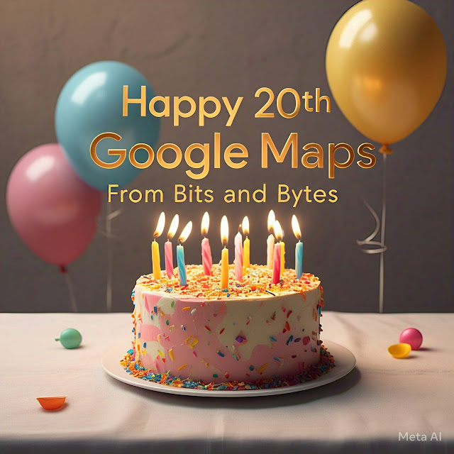
It was 20 years ago today when Google Maps was publicly released.

In 2003, Lars and Jens Rasmussen, Noel Gordon, and Stephen Ma, the founders of Where 2 Technologies, developed Expedition, a standalone desktop mapping software application in Sydney, Australia.

While the exact programming language for Expedition isn’t known (at least I haven’t found it), it likely used C++ for its mapping software and Geographic Information Systems (GIS), which involves managing and analyzing location-based data.

Expedition, with its user-friendly interface, laid the groundwork for the future development of Google Maps.
Google acquired Where 2 Technologies in October of 2004, after a reportedly fast-paced three-week negotiation with Google’s co-founder, Larry Page.

Google quickly transitioned Expedition into a web application, paving the way for the launch of Google Maps Feb. 8, 2005, featuring zoomable maps, driving directions, and a search function.

A Fresno Bee newspaper article, published Feb. 9, 2005, stated, “Google Maps puts the company squarely in competition with Yahoo Inc. and America Online Inc.’s MapQuest, part of Time Warner, Inc.”

MapQuest, one of the first web-based mapping services, was launched in 1996.

In 2005, Google Maps used JavaScript for dynamic user interface (UI) elements, allowing users to pan (move the map view in any direction), zoom in and out, and interact with information windows and the search bar.

Clicking on a pin or icon on the map (often shaped like a teardrop or a flag) activates the interactive feature that displays location details, such as the name and address of a business.

This interactive feature is primarily powered by JavaScript using AJAX (Asynchronous JavaScript) and XML (Extensible Markup Language) for data exchange.

AJAX enables asynchronous updates, allowing Google Maps to retrieve and display new data in nearly real-time without refreshing the page, and enhances background updates and dynamic responses to user interactions.

In 2005, Google Maps likely used XML to exchange data between browsers and servers, including map tiles, business location details, points of interest, search results, and direction data.

At the time, XML was a standard format for data exchange in AJAX-based web applications.

HTML (HyperText Markup Language) was used for web elements such as the search bar and pop-up windows.

CSS (Cascading Style Sheets) handled the visual elements, including colors, fonts, and overall design.

I compiled a list of the milestone years in the evolution of Google Maps:

2005: Google launched Google Maps, featuring satellite imagery, zoomable maps, driving directions, and a search function.

2007: ‘Street view’ offered 360-degree street-level imagery.

2008: Public transit directions became available, as did the mobile app providing turn-by-turn navigation.

2009: Google Maps added walking and cycling directions.

2011: Google Maps introduced indoor maps for malls, airports, and stadiums.

2012: Offline Google Map usage without an internet connection became available.

2014: Real-time traffic updates with alternate routes were added.

2015: Google began integrating AI-powered personalized recommendations for dining and other attractions, which today remains a process of continuous development and improvement.

2016: Google integrated ride-hailing services like Uber and also improved its offline navigation.

2017: Real-time location sharing allowed users to share their location with others.

2018: Google Maps became linked with Google Assistant and Google Photos.

2019: Google’s ‘live view’ introduced using augmented reality to overlay turn-by-turn directions on a smartphone’s camera.

2023: ‘Immersive view,’ combining street view and aerial imagery, was launched, allowing users to explore cities and landmarks in a more realistic 3D virtual environment.

2024: At the Google I/O (Innovation in the Open) developers conference, the company announced new location-aware AR features for live view.

Although not yet available to the public, location-aware AR will enable more precise placement of virtual objects and provide richer information about landmarks, businesses, and points of interest by overlaying historical images or 3D models.

As with nearly everything else these days, Google Maps uses artificial intelligence (AI) and machine learning (ML) to enhance accuracy and personalization.

AI analyzes satellite imagery and street view data to improve map updates by detecting roads, buildings, and landmarks.

ML forecasts traffic patterns, delays, and optimal routes using real-time and historical data, and provides personalized recommendations for restaurants and other businesses or activities based on user preferences and location history.

Google Maps also uses natural language processing (NLP) to understand human language.

Google Maps uses NLP to analyze reviews to gauge opinions and identify fake ones, interpret local search queries like “coffee near me,” and address user feedback on map issues and reviews.

Google Maps also employs neural radiance fields (NeRF), a relatively new AI technique that creates incredibly realistic 3D models from images.

NeRF technology enhances immersive view in Google Maps, allowing for more detailed and virtual explorations of places.

Google Maps depends on a robust telecom infrastructure, including 5G mobile networks, to support navigation, immersive view, and real-time features.

With low latency and high bandwidth, 5G is vital for delivering precise and reliable location data.

The internet backbone and CDNs (content delivery networks) ensure Google Maps’ global reach and efficient data distribution.

Location services in Google Maps depend on satellite GPS, GNSS (global navigation satellite systems), and terrestrial positioning methods like cellular and Wi-Fi triangulation to provide accurate location data.

Reflecting on the past, I, like many of you, remember the frustration of unfolding and refolding AAA paper maps that felt like working a jigsaw puzzle.

I’m glad we have Google Maps, and now it’s time to blow out those 20 candles!